|
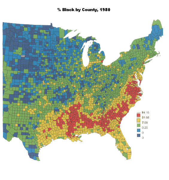
To
grasp the significance of the racial realignment of the Republican and Democratic
parties, the geographic distribution of blacks in 1980 provides a useful
guideline. The continuing geographic legacy of slavery is evident in the
high concentrations of blacks in the Southern "Black Belt" (so
named for its rich black soil, not for its racial composition) running from
Virginia to the Mississippi. However, in contrast with 1880,
blacks are also substantially represented in the Northeast corridor from
Philadelphia through N.J., New York City to Hartford; along I-94 from Detroit
to Chicago, and in scattered urban areas (e.g., Buffalo, Pittsburgh). Watch
these areas closely in the final map on this tour. |
|